
|
|
Природна забележителност Каме... Природна забележителност Каменни г... Природна забележителност Каменни гъби Природна забележителност Каменни гъби |
|
|
Археологически парк "Тополниц... Археологически парк "Тополница" и ... Археологически парк "Тополница" и парак... Археологически парк "Тополница" и параклисът... |
|
|
Скално-култов тракийски компл... Скално-култов тракийски комплекс н... Скално-култов тракийски комплекс над се... Скално-култов тракийски комплекс над село Но... |
|
|
Антична крепост "Перистера" Антична крепост "Перистера" Антична крепост "Перистера" Антична крепост "Перистера" |
|
|
Белоградчишките скали и крепо... Белоградчишките скали и крепостта ... Белоградчишките скали и крепостта „Кале... Белоградчишките скали и крепостта „Калето“ |
|
|
Раювски кромлех и паметника н... Раювски кромлех и паметника на Въл... Раювски кромлех и паметника на Вълчан В... Раювски кромлех и паметника на Вълчан Войвод... |
|
|
Меандърът край град Маджарово Меандърът край град Маджарово Меандърът край град Маджарово Меандърът край град Маджарово |
|
|
Местност „Скумсале“ до град С... Местност „Скумсале“ до град Стрелча Местност „Скумсале“ до град Стрелча Местност „Скумсале“ до град Стрелча |
|
|
Карталските водопади край Вел... Карталските водопади край Велико Т... Карталските водопади край Велико Търново Карталските водопади край Велико Търново |
|
|
Средновековната крепост Мезек... Средновековната крепост Мезек (Неу... Средновековната крепост Мезек (Неутзико... Средновековната крепост Мезек (Неутзикон) |
|
|
Тракийска куполна гробница Ме... Тракийска куполна гробница Мезек Тракийска куполна гробница Мезек Тракийска куполна гробница Мезек |
|
|
Средновековна крепост и връх ... Средновековна крепост и връх Моняк Средновековна крепост и връх Моняк Средновековна крепост и връх Моняк |
|
|
Бекови скали и Червената скала Бекови скали и Червената скала Бекови скали и Червената скала Бекови скали и Червената скала |
|
|
Алпийски тролей ZipLine Чепел... Алпийски тролей ZipLine Чепеларе Алпийски тролей ZipLine Чепеларе Алпийски тролей ZipLine Чепеларе |
|
|
Античен фестивал "Нике - игра... Античен фестивал "Нике - играта и ... Античен фестивал "Нике - играта и побед... Античен фестивал "Нике - играта и победата" |
|
|
Крепост Топлица в местност Св... Крепост Топлица в местност Свети д... Крепост Топлица в местност Свети дух, М... Крепост Топлица в местност Свети дух, Минера... |
|
|
Тракийско скално светилище кр... Тракийско скално светилище край се... Тракийско скално светилище край село Не... Тракийско скално светилище край село Небеска |
|
|
Пещера "Добростански бисер" Пещера "Добростански бисер" Пещера "Добростански бисер" Пещера "Добростански бисер" |
|
|
Кромлех край село Долни Глава... Кромлех край село Долни Главанак Кромлех край село Долни Главанак Кромлех край село Долни Главанак |
|
|
Средновековна крепост Хоталич Средновековна крепост Хоталич Средновековна крепост Хоталич Средновековна крепост Хоталич |
|
|
Исторически музей в град Стре... Исторически музей в град Стрелча Исторически музей в град Стрелча Исторически музей в град Стрелча |
|
|
Водопад Сливодолското падало Водопад Сливодолското падало Водопад Сливодолското падало Водопад Сливодолското падало |
|
|
Тракийско скално светилище Бе... Тракийско скално светилище Бегликт... Тракийско скално светилище Бегликташ Тракийско скално светилище Бегликташ |
|
|
Пармак кая край село Ночево Пармак кая край село Ночево Пармак кая край село Ночево Пармак кая край село Ночево |
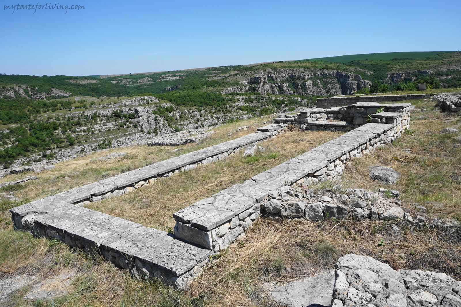
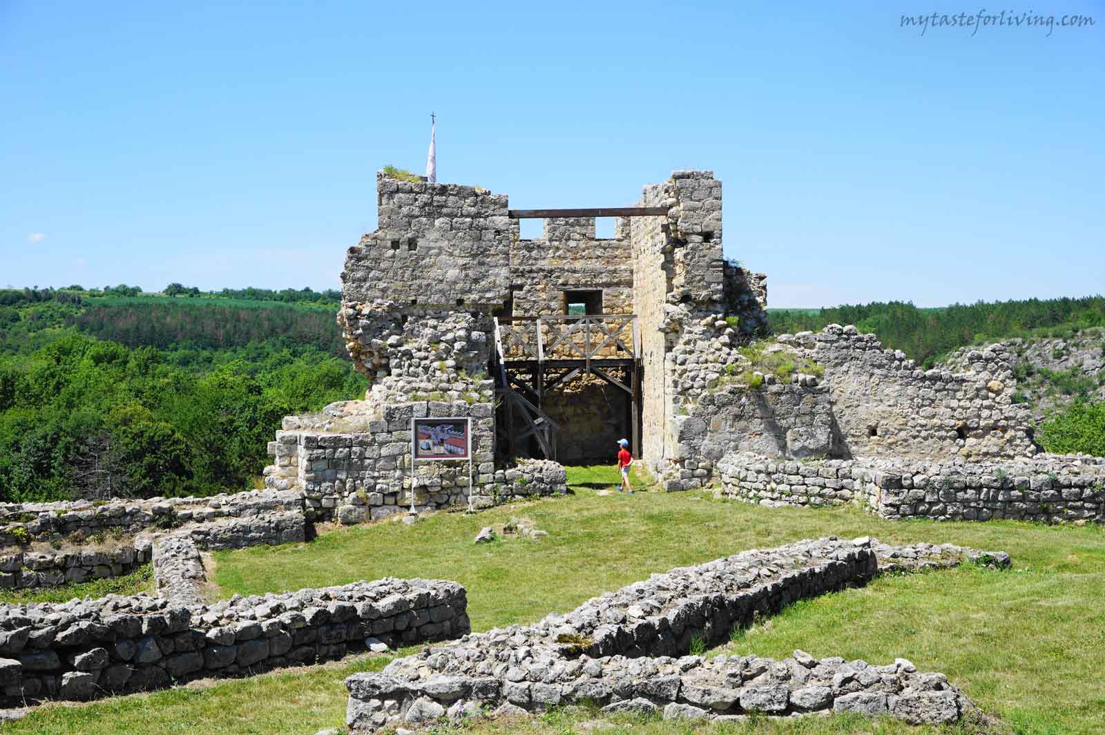
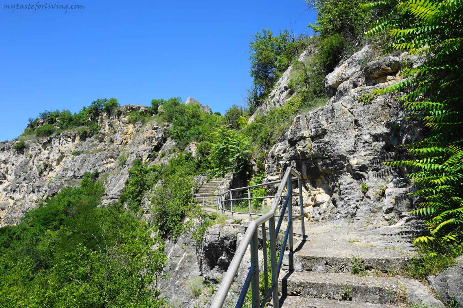
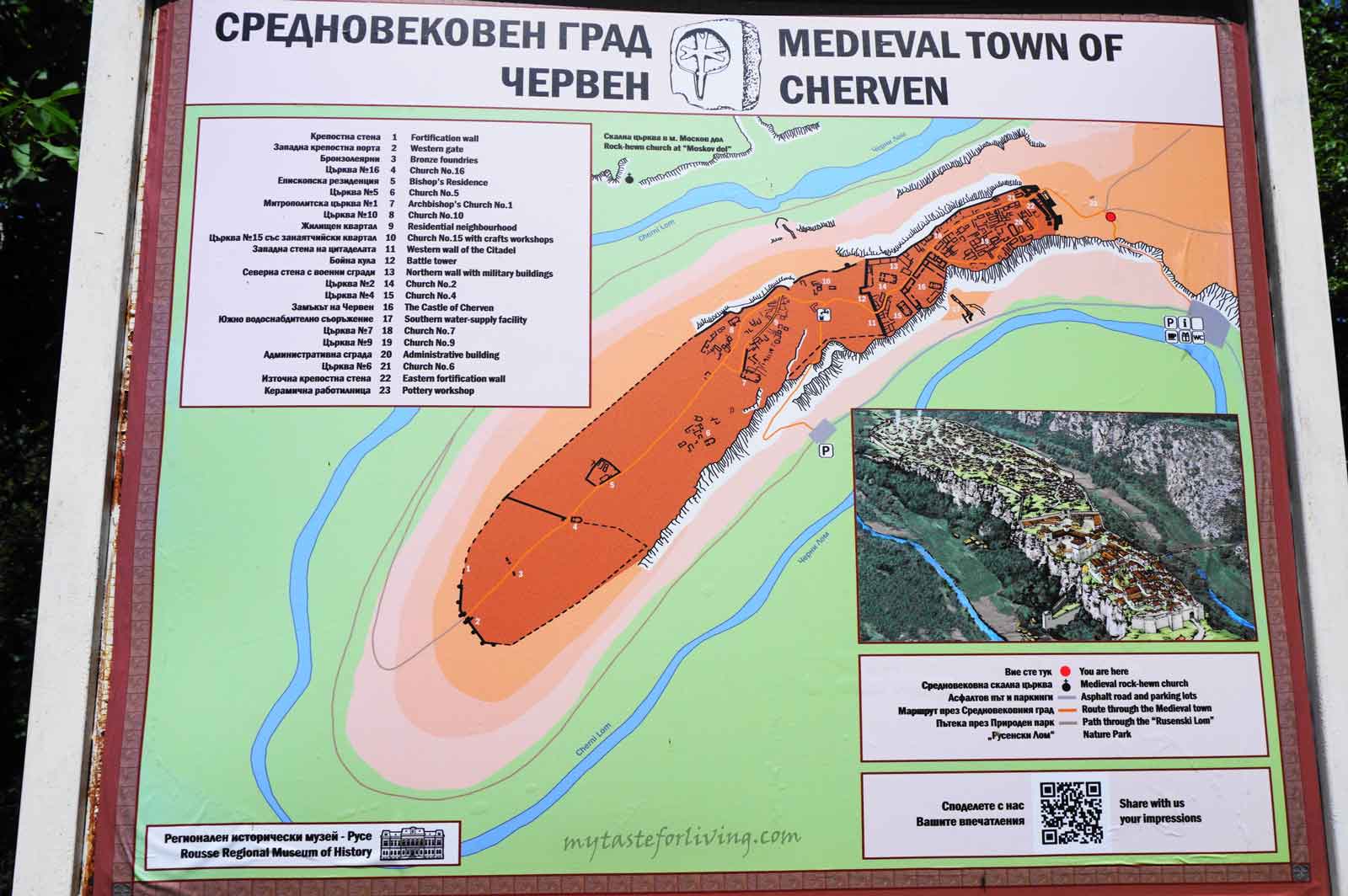
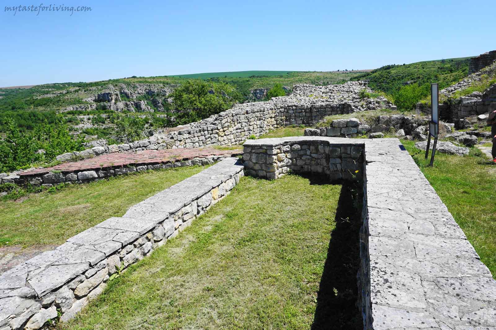
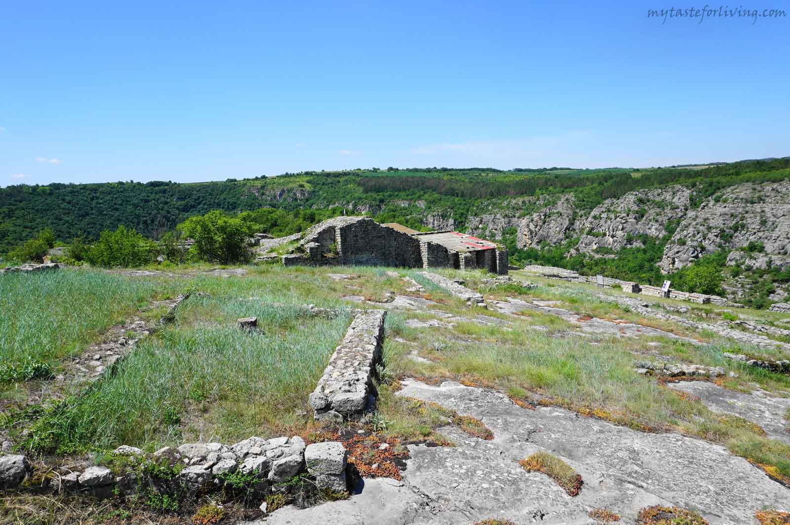
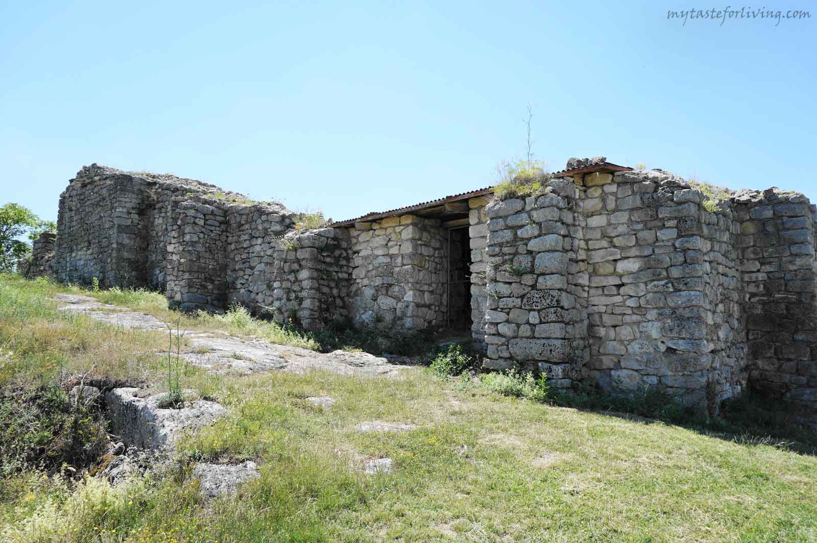
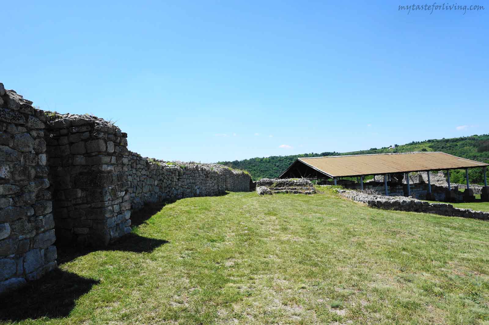
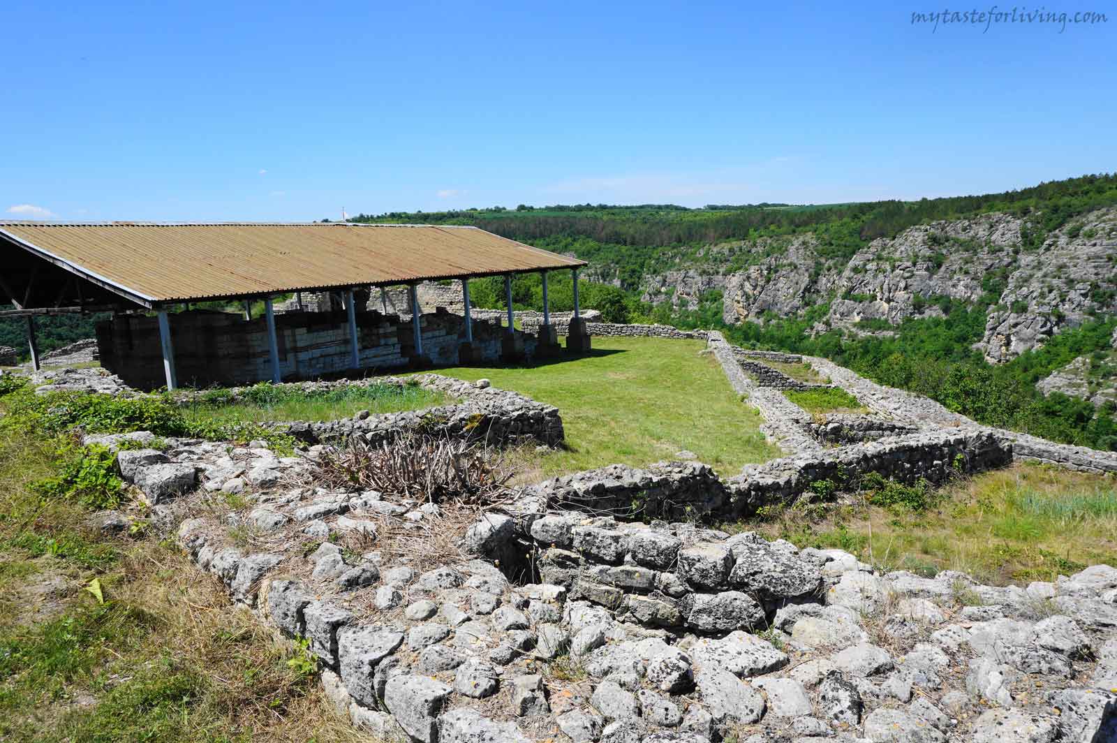
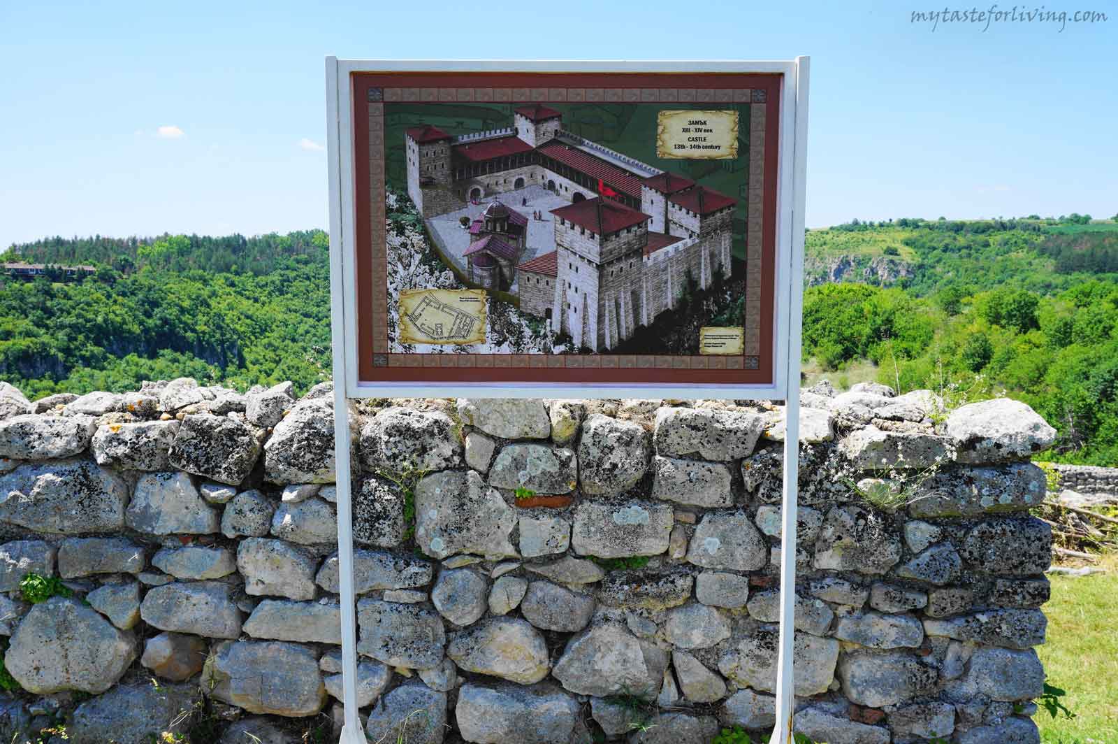
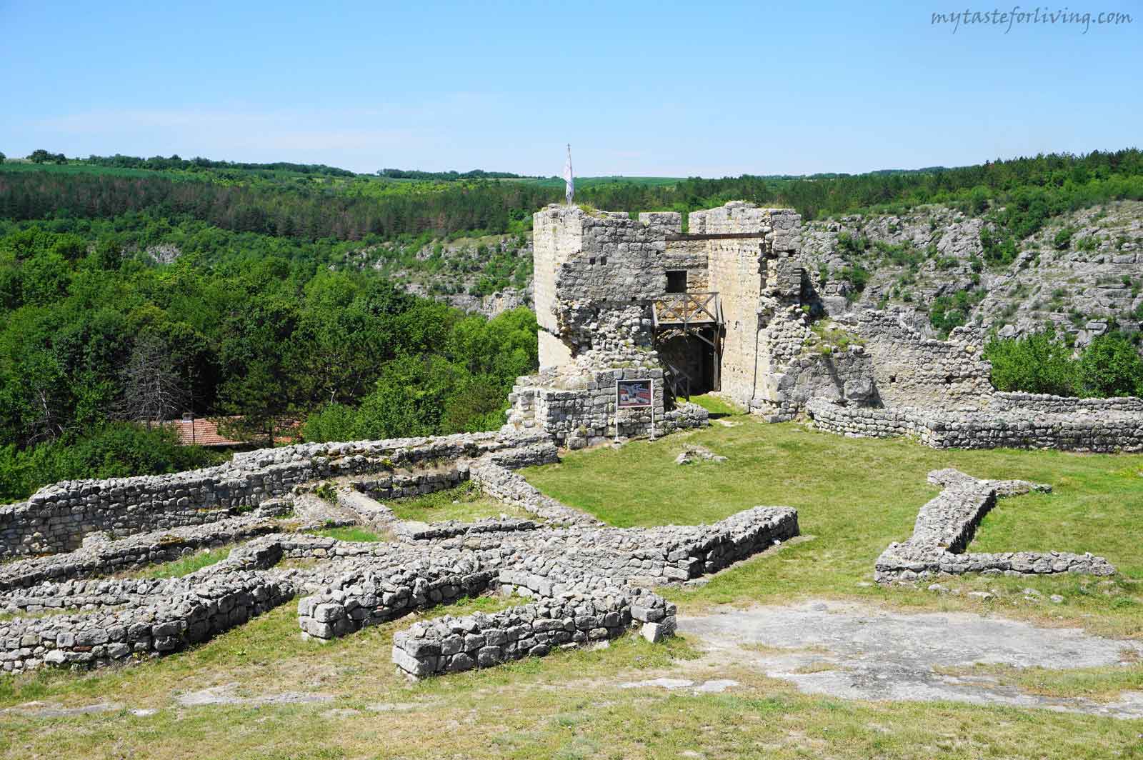
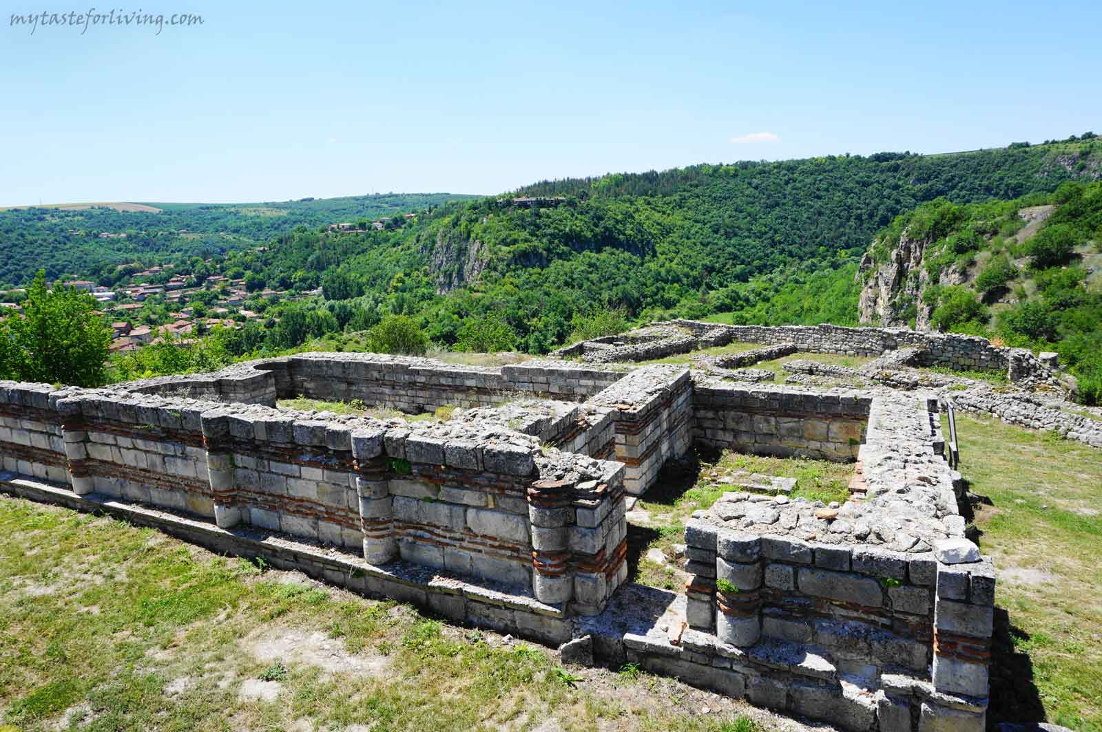
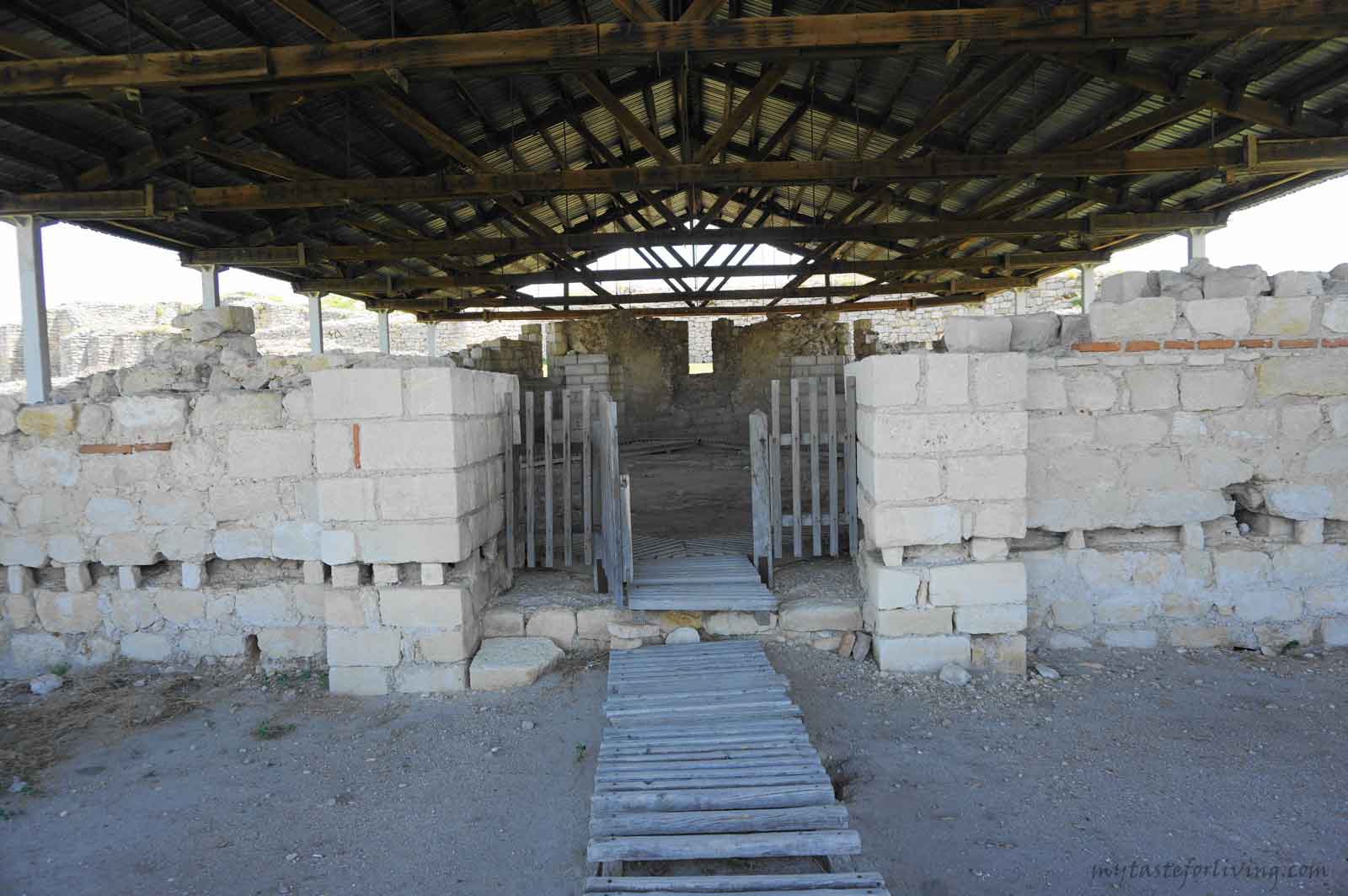
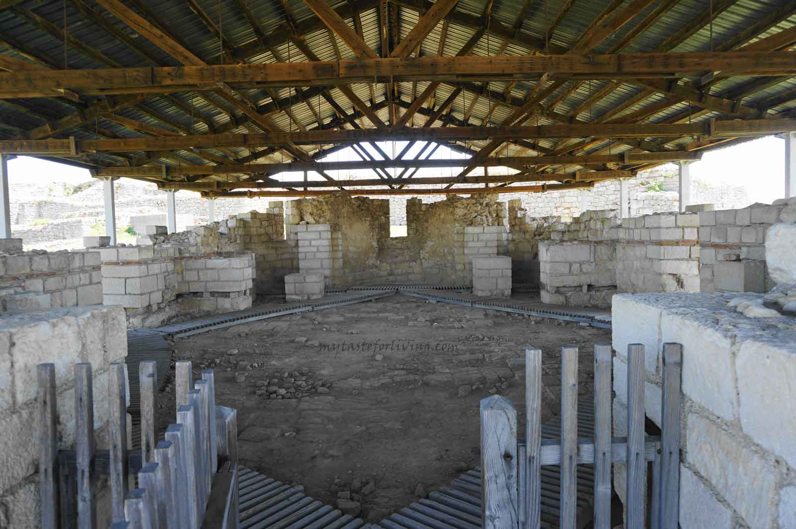
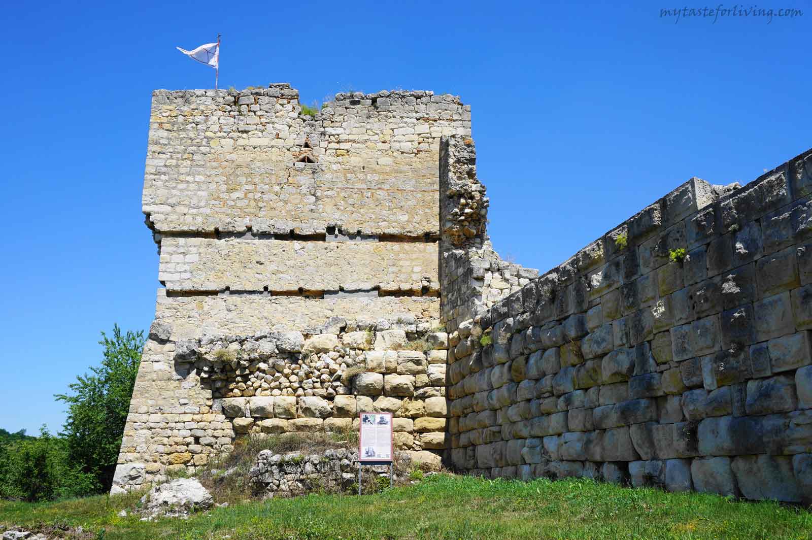
Средновековен град и крепост Червен

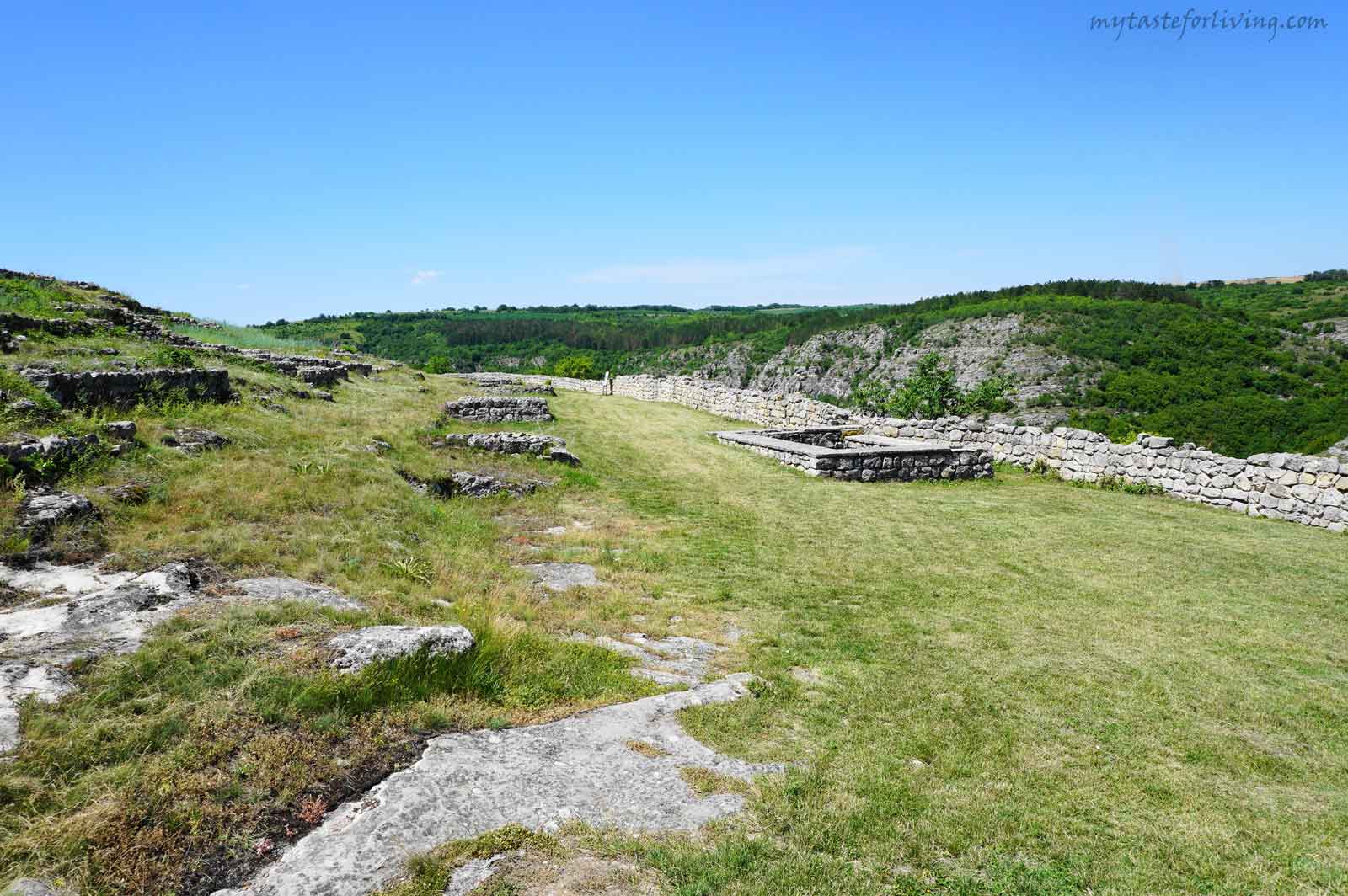
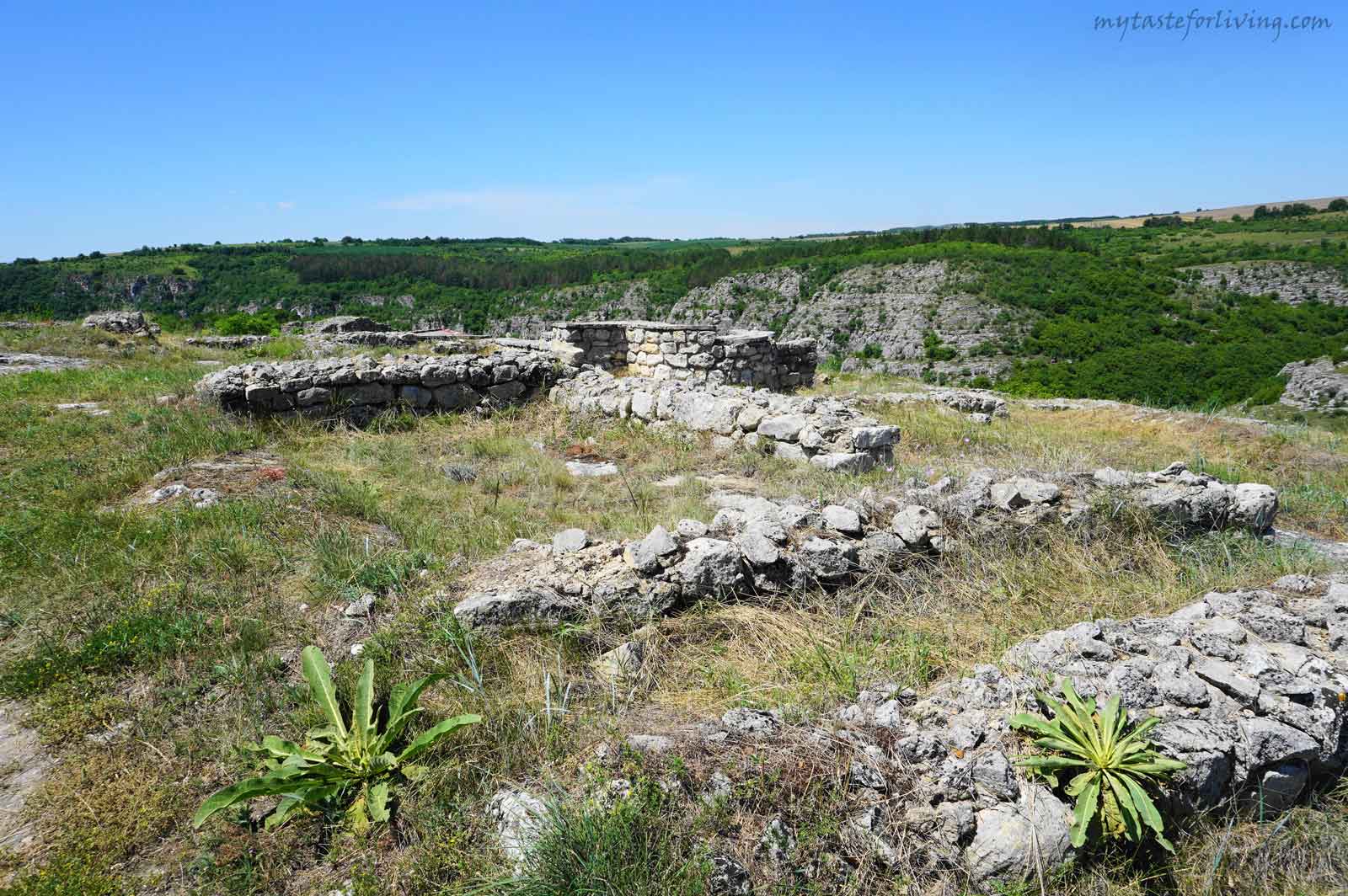
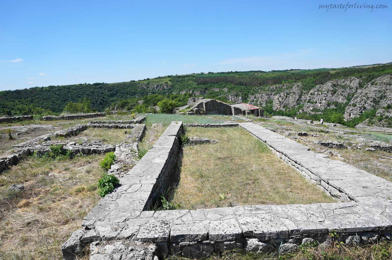
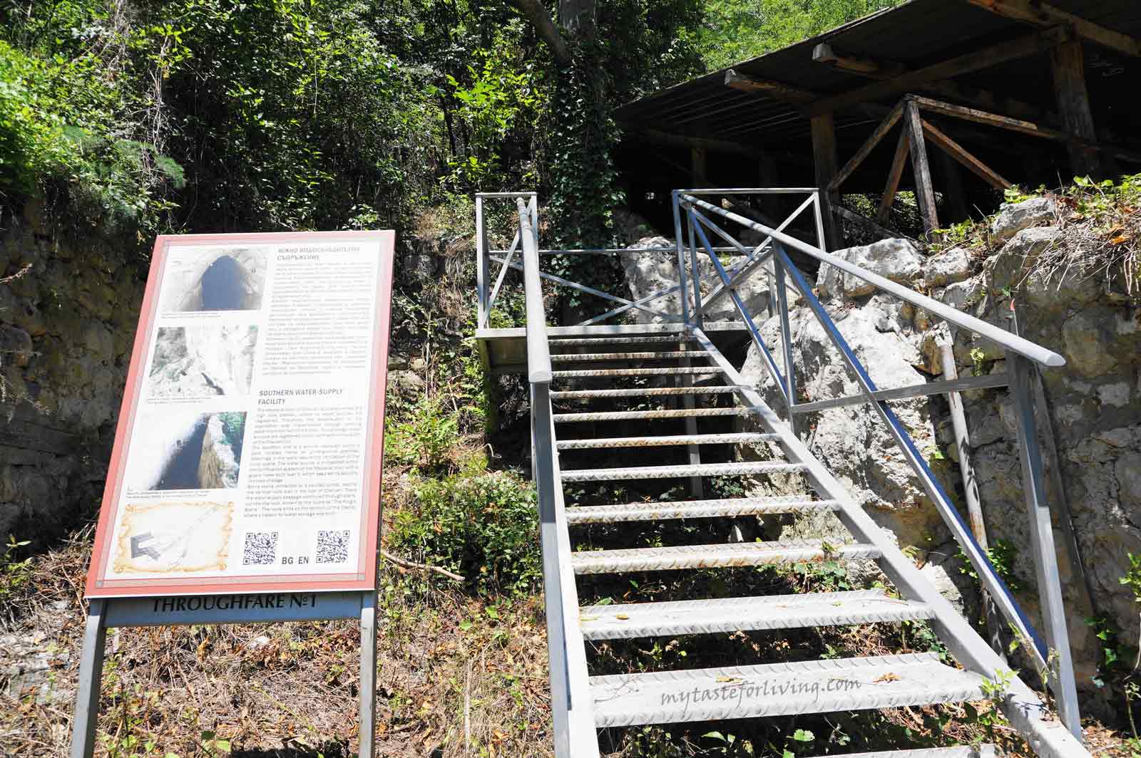
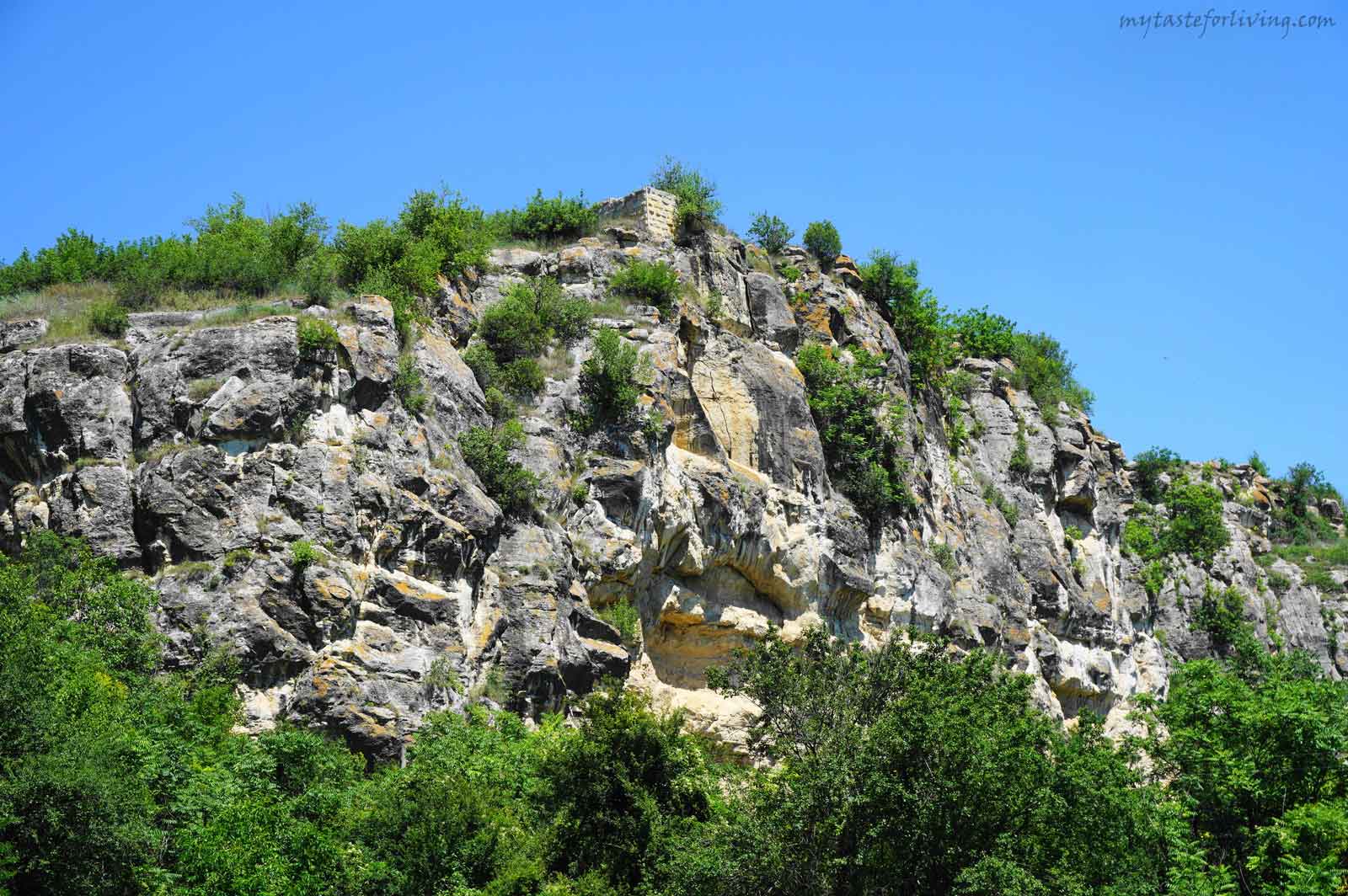
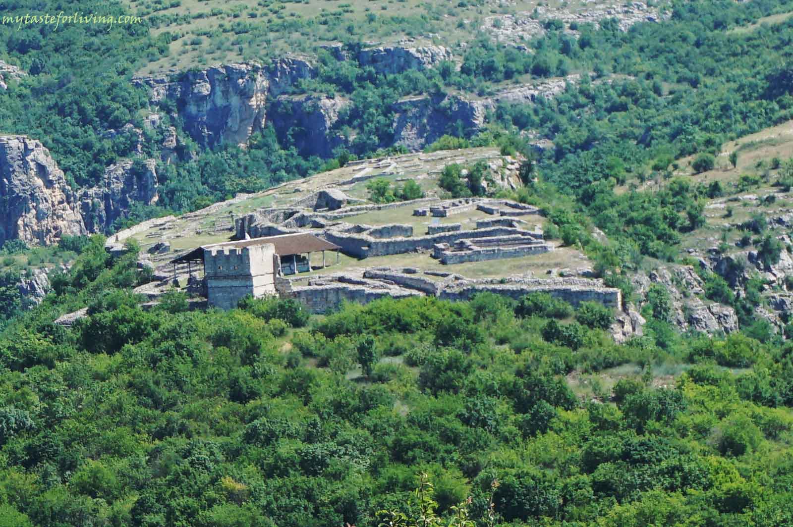
Средновековният град Червен се намира в границите на природен парк „Русенски Лом“, на около 35 км. от град Русе, до село Червен. Той е един от най-значимите военно-административни, църковно-културни и стопански центрове на Второто българско царство (12 – 15 в.) и е наследник на ранновизантийска крепост от 6 век.
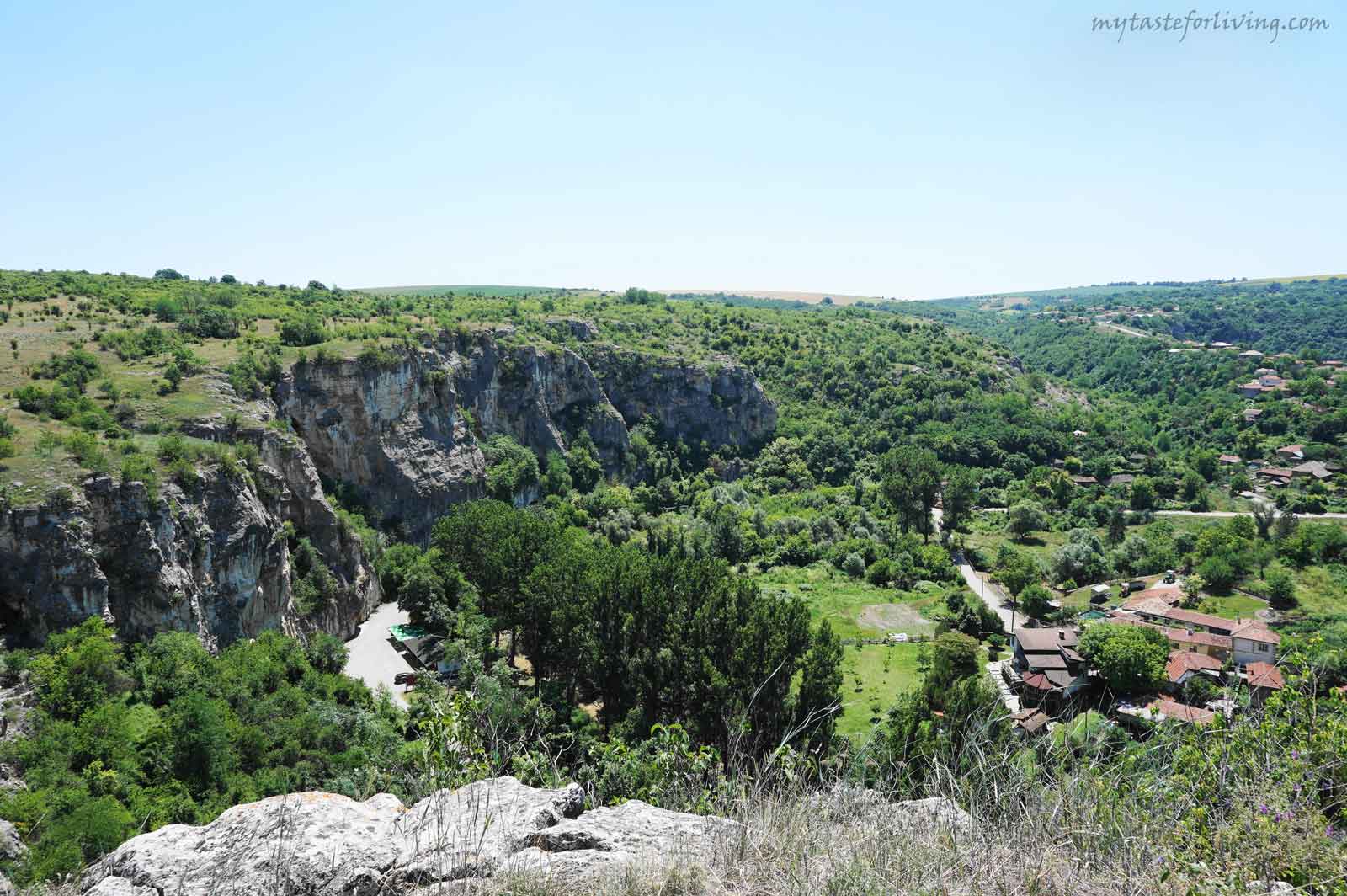
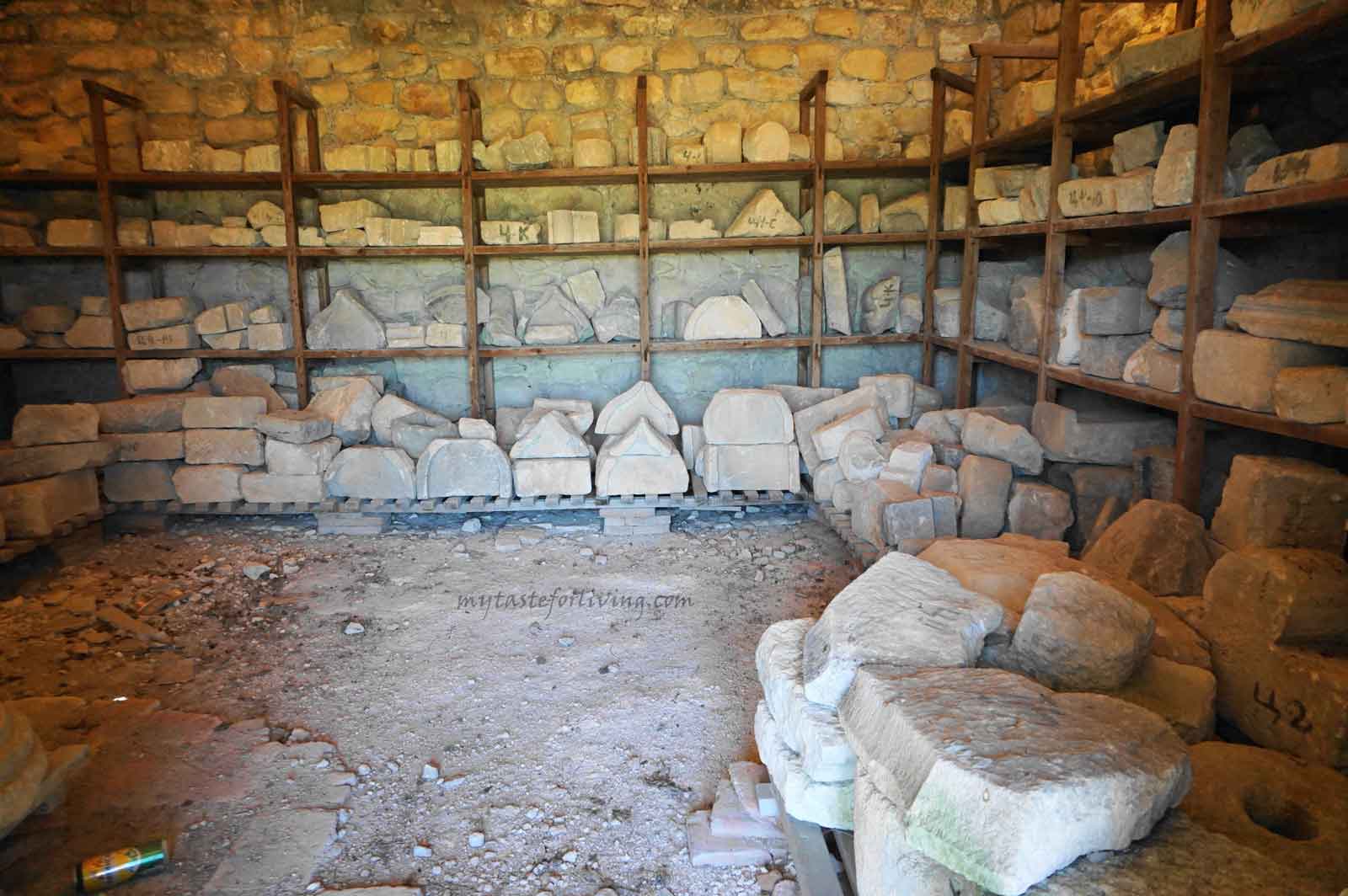
Средновековното селище е разположено върху високо скално плато по поречието на река Черни Лом със спираща дъха гледка. Състояло се е от голям замък (цитадела), крепостни стени, външен град (разположен в низините), подземни водоснабдителни проходи, обществено-административни сгради, църкви, улична мрежа, жилищни сгради и работилници. При археологически находки там са открити накити, паметници, керамика, съкровища, занаятчийски инструменти, предмети от бита и др.
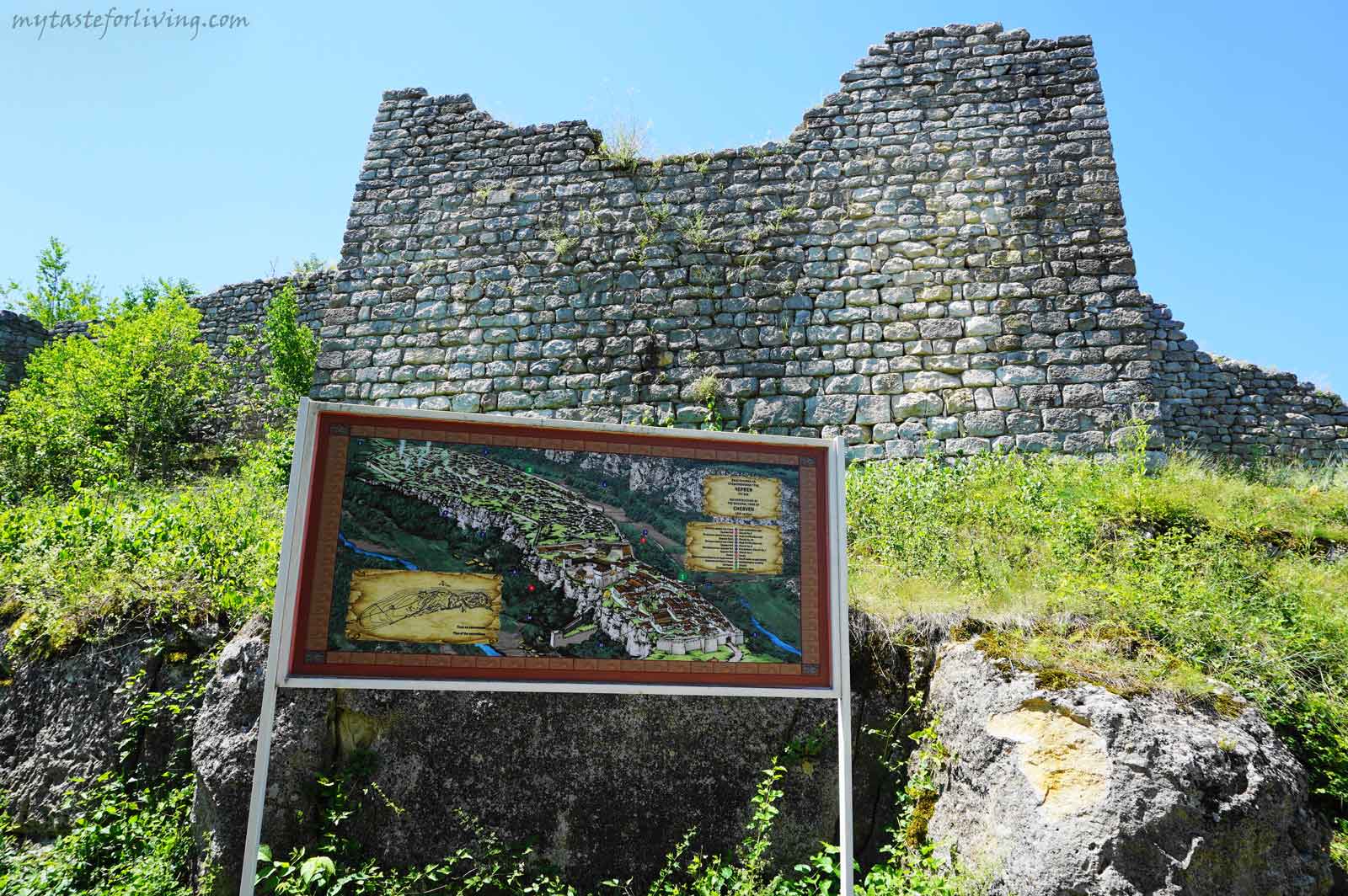
През 1235 г. станал седалище на Червенската митрополия. Бил е важна пътна спирка от река Дунав към вътрешността на страната. Интересен факт е, че по време на археологическите проучвания на Източната крепостна стена е разкрит надгробен камък с надпис, посветен на унгарската принцеса Ана-Мария – съпруга на цар Иван Асен II, починала през 1237 година.
През 1388 г. средновековното селище е нападнато и опустошено от османските турци. През 17 в. изживял нов период на стопанско оживление.
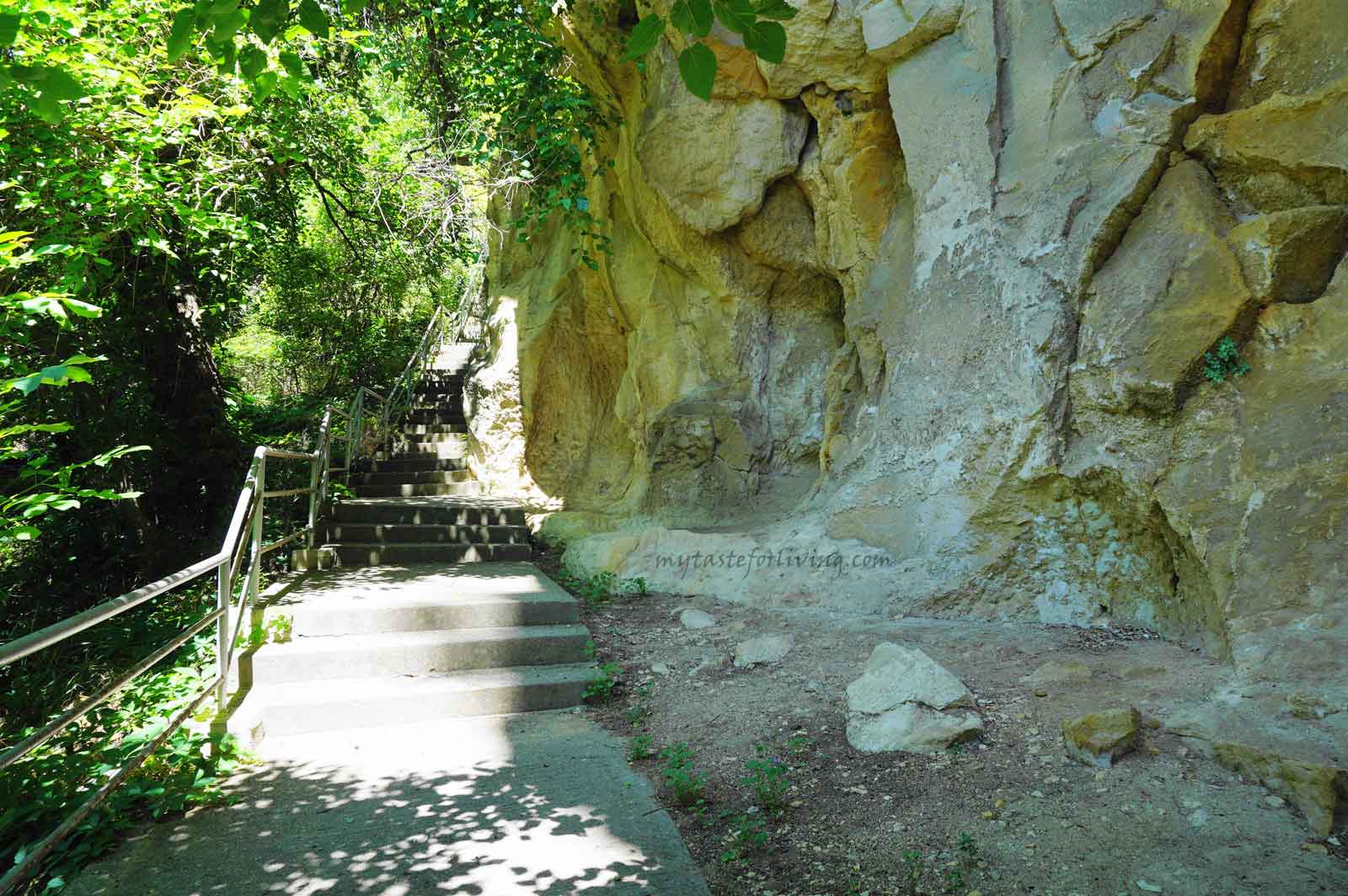
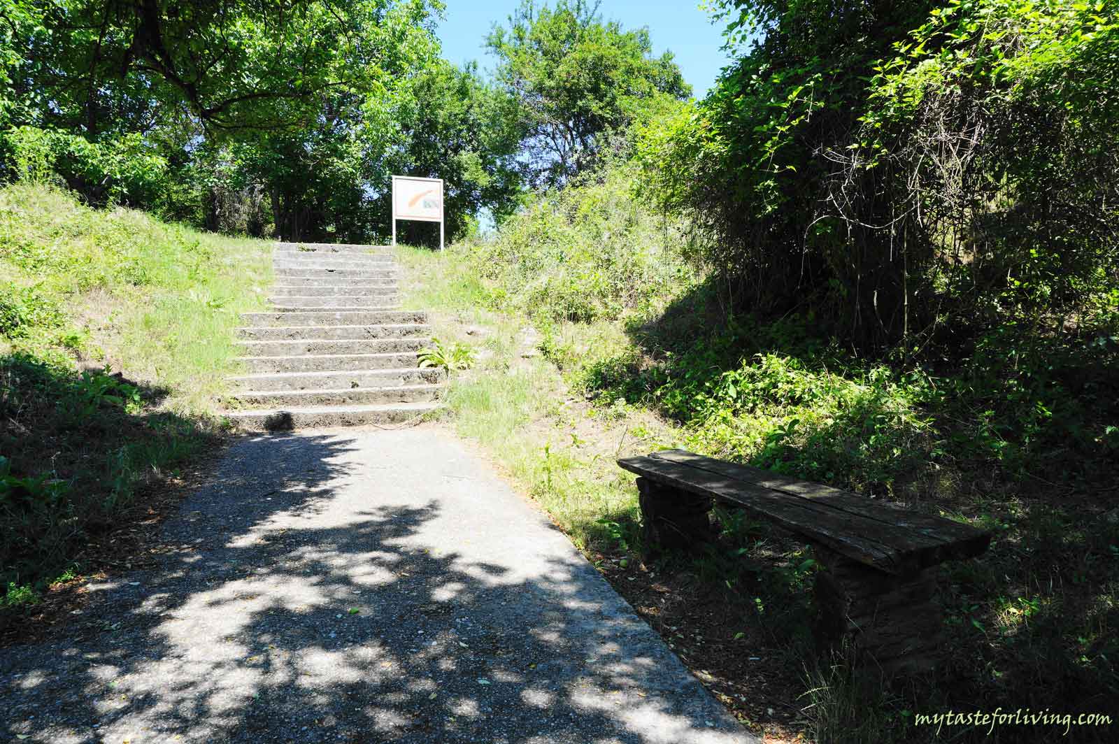
Как стигнахме до там? Следвайки указателните табели и Google Maps, достигнахме голям и широк паркинг, където има кафене. Там може да закупите билети за крепостта, да се освежите с напитка или да се подкрепите с нещо за ядене.
Средновековният град и крепост Червен е обявен за национален археологически резерват. Разходката до средновековните му руини може да съчетаете с посещение на пещера Орлова чука и Ивановските скални църкви, включени в Списъка на световното културно и природно наследство под закрилата на ЮНЕСКО.
Вижте още

Ивановски скални църкви
Ивановските скални църкви са включени в Списъка на световното културно и природно наследство под закрилата на ЮНЕСКО. Te се намират в границите на природен парк „Русенски Лом“, на в близост до град Русе, до село Иваново. В района има много малки скални църкви, параклиси и килии, които образуват манастирския венец носещ името „Св. Архангел Михаил”.
Разгледай
Еленската базилика
Еленската базилика се намира между град Пирдоп и село Антон, в подножието на южните склонове на Златишко-Тетевенския дял на Стара планина. Мястото е изключително спокойно, много приятно за разходка сред природата и подходящо за пикник.
Разгледай
Тракийска крепост в местност Асар Кая
Местността Асар Кая се намира на по-малко от два километра от село Женда, община Черноочене, област Кърджали. Крепостта се намира на върха на висока скална тераса, която е изградена от струпани камъни, по които може да забележите множество скални ниши. Смята се, че мястото е свещено още от времето на траките.
Посещения 29760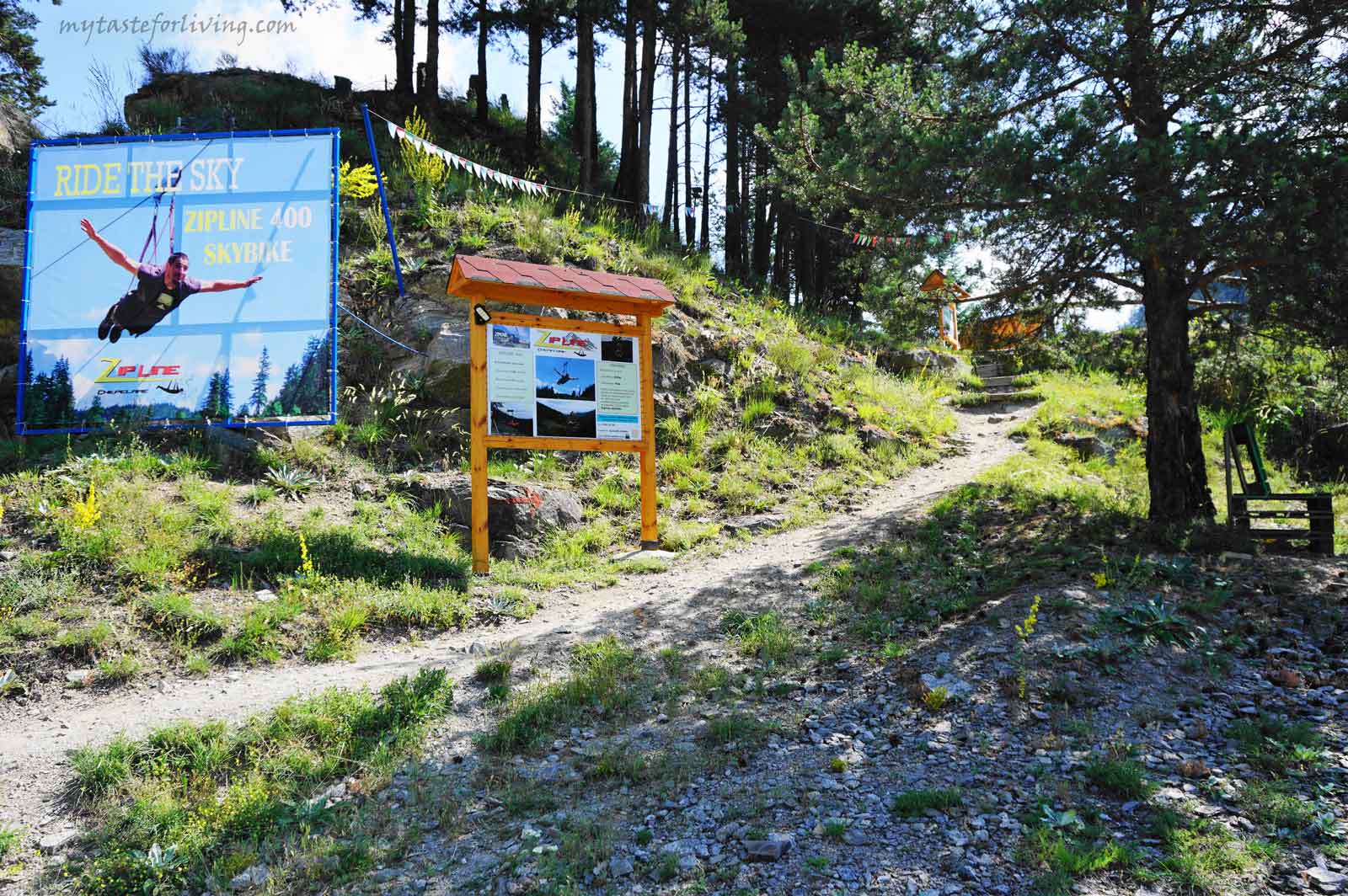
Алпийски тролей ZipLine Чепеларе
За любителите на екстремни преживявания силно препоръчвам да посетите Алпийски тролей ZipLine Чепеларе! Три вида атракции ще повишат адреналина ви там - ZipLine 400 – SkyBike, ZipLine Чепеларе и Железният път. Намират се на пътя от Асеновград към Чепеларе, на 2 км в ляво преди Чепеларе (има указателни табели). Има две отбивки, където може да паркирате.
Посещения 15226
Раювски кромлех и паметника на Вълчан Войвода
Раювският кромлех и паметника на Вълчан Войвода се намират в село Раювци, в красивия Еленския балкан, до бреговете на язовир Йовковци.
Посещения 14536
Коментари
Оставете коментар